ここから本文です。
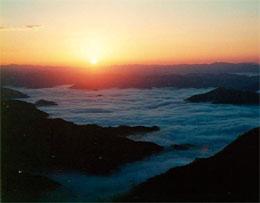
京都丹波高原国定公園 Kyoto Tamba Kogen Quasi-National Park
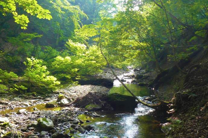
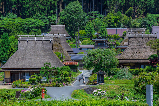
京都府の中央部である京都市、綾部市、南丹市、京丹波町にまたがる丹波高原の広大な区域が京都丹波高原国定公園です。由良川の源流である芦生の森は、原生的な自然を有し、希少な動植物の生息地でもあります。また、かやぶき屋根の特徴的な民家が多数残されている集落など、自然と寄り添う暮らしと、伝統文化を幾世代も受け継いできた歴史を感じることができます。京都の市街地に近接するこの地域は、日本海と京の都を結ぶ多くの街道が通る地域であり、自然と文化が融合した風致が特筆されるユニークな国定公園です。
■所在地:京都市、綾部市、南丹市、京丹波町
■指定年月日:平成28年3月25日(一部変更:令和2年3月31日)
■面積:68,851ha(一部変更後の面積:69,158ha)
Large tract of land of Tamba Kogen that ranges Kyoto city, Ayabe City, Nantan City and Kyotamba Town in the central part of Kyoto prefecture is Kyoto Tamba Kogen Quasi-National Park. The forest of Ashio that is the source of Yura River has pristine nature and home of rare fauna and flora.
There are villages with many thatched houses unique to them, and one can feel the history of people living with nature and preserving the traditions over generations. This area adjacent to the city of Kyoto has had many roads that connected Japan Sea and the ancient capital of Kyoto, and the integration of nature and culture is the noteworthy characteristics of this unique Quasi-National Park.
■ Location: Kyoto City, Ayabe City, Nantan City and Kyotamba Town
■ Designation Date: March 25, 2016(change Date:March 31,2020)
■ Area: 68,851ha(change Area:69,158ha)
京都丹波高原国定公園のエリア紹介 Areas of Kyoto Tamba Kogen Quasi-National Park
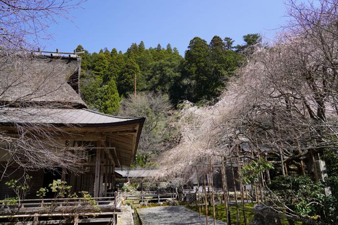
花脊の里 Hanase Village
京北・山国地域 Keihoku and Yamaguni area
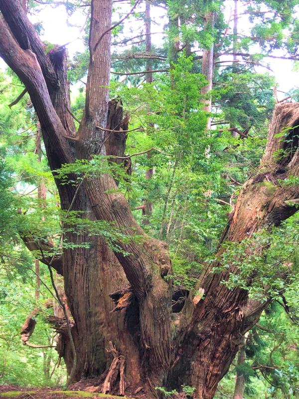
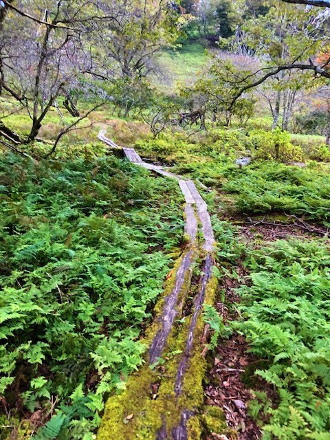
芦生の森 Ashiu Forest
かやぶきの里 Kayabuki-no-sato

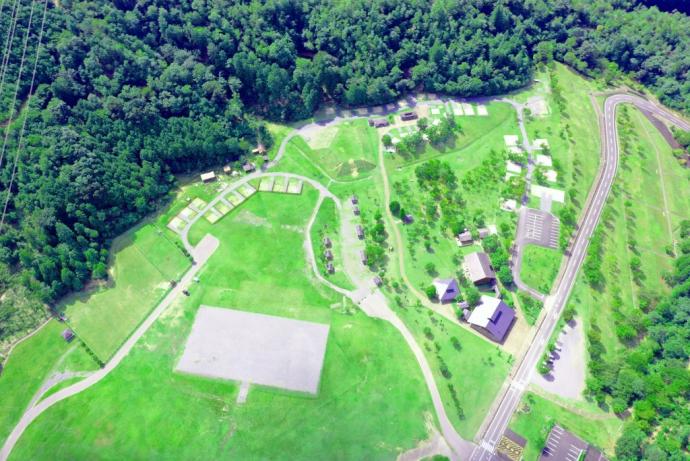
大野ダム公園 Ohno Dam Park
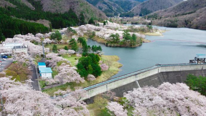
天若湖 Amawaka Lake
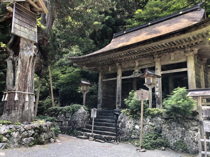
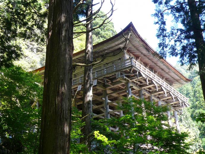
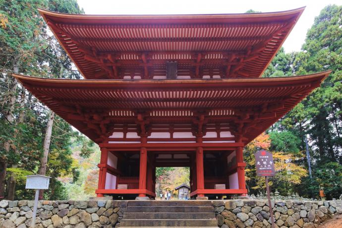
君尾山・光明寺 Mt. Kimino-san and Komyo-ji Temple
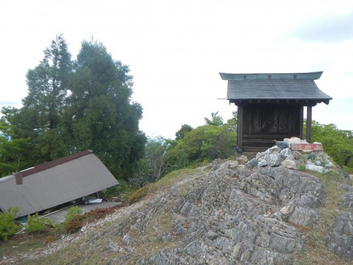
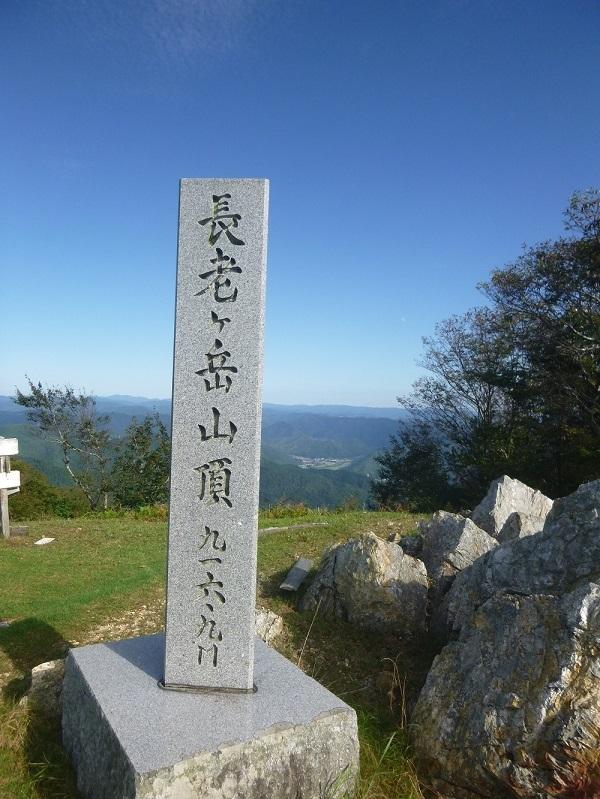
仏主・長老ヶ岳 Hodosu and Mt. Choro-ga-take
区域図 Area Map
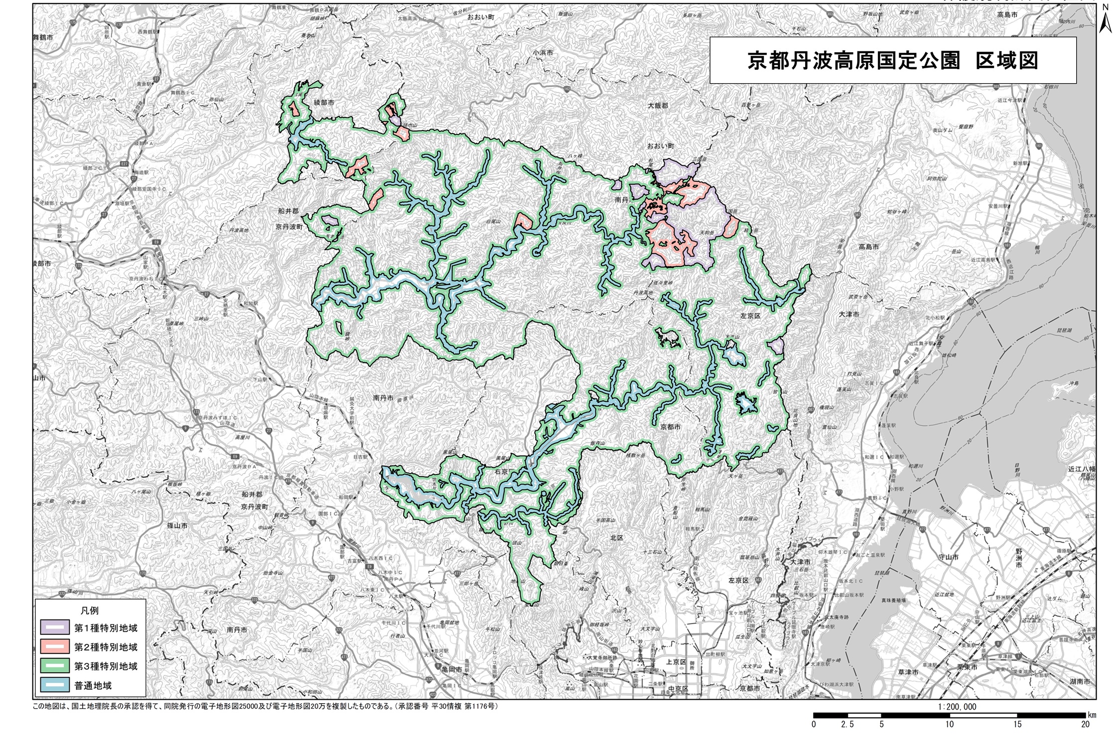
→ こちらをクリックしていただくと大きいサイズの画像が表示されます。(JPG:1,578KB)
-> Click here to enlarge.(JPG:1,578KB)
注:区域拡大については、「京都丹波高原国定公園の区域拡大について」をご確認ください。
|
地種区分 |
定義 definition |
面積 area |
|---|---|---|
| 第1種特別地域 | 現在の景観を極力維持する必要のある地域 | 2,485ha |
| Classification 1 Special Areas |
Areas that need to preserve the current scenic beauty with utmost effort | |
| 第2種特別地域 | 農林漁業活動について調整を図ることが必要な地域 | 1,850ha |
| Classification 2 Special Areas |
Areas that need to control the activities of agriculture, forestry and fisheries | |
| 第3種特別地域 | 通常の農林漁業活動については原則容認する地域 | 56,294ha |
| Classification 3 Special Areas |
Areas that allow normal activities of agriculture, forestry and fisheries | |
| 普通地域 | 特別地域の風景維持のための緩衝地帯として必要な地域 | 8,529ha |
| Ordinary Areas | Areas that needs to function as buffer areas to preserve the scenic beauties of the special areas |
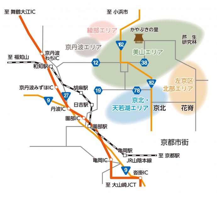
アクセスマップ Access Maps
詳しい地図情報を見る(京都府・市町村共同地理情報システム)(外部リンク)
詳しい地図情報を見る(環境アセスメントデータベースEADAS〔イーダス〕)(外部リンク)
美山エリア(中・西部) Miyama Area (Middle and Western parts)
車利用の場合…園部ICから南丹市かやぶきの里まで 約40分
By Car…About 40 minutes from Sonobe Exit to Nantan City’s Kayabuki no Sato.
美山エリア(芦生地区) Miyama Area (Ashio district)
車利用の場合…園部ICから南丹市芦生まで約1時間20分
(かやぶきの里経由)
By car…About 1 hr. and 20 min. from Sonobe Exit to Ashio, Nantan City.
左京区北部エリア Northern Area of Sakyo-ku
車利用の場合…京都市内から左京区花脊まで 約1時間
By car…About 1 hr. from Kyoto City to Hanase in Sakyo-ku.
綾部エリア Ayabe Area
車利用の場合…京丹波わちICから綾部市睦寄まで 約30分
By car…About 30 min. from Kyoto-Tamba-Wachi Exit to Mutsuyori of Ayabe City.
京北・天若湖エリア Keihoku, Lake Amawaka Area
車利用の場合
京都市街から右京区京北まで 約1時間、京都市街から天若湖まで 約1時間
By car:
About 1 hr. from Kyoto City to Keihoku of Ukyo-ku, about 1 hr. from Kyoto City to Lake Amawaka.
JR利用の場合
JR京都駅からJR日吉駅までJR山陰本線で 約1時間、JR日吉駅から天若湖まで南丹市営バスで 約10分 By JR train:
About 1 hour from Kyoto Station to Hiyoshi Station on JR Sanin-Honsen, and then about 10 minutes by the city bus from Hiyoshi Station to Lake Amawaka.
京丹波エリア Kyo-Tamba Area
車利用の場合…京丹波わちICから京丹波町仏主まで 約30分
By car…About 30 min. from Kyo-Tamba-Wachi Exit to Hodosu, Kyoto-Tamba Town.
お問い合わせ
総合政策環境部自然環境保全課
京都市上京区下立売通新町西入薮ノ内町
電話番号:075-414-4706
ファックス:075-414-4705